Part II of the Split Rock Lighthouse State Park posting
As I mentioned at the end of the Split Rock post, on our first trip to the north shore we went on a more ambitious hike than we were maybe prepared for at Tettegouche. We knew we wanted to check out Tettegouche State Park based on all the great reviews and plentiful hiking trails.

Tettegouche State Park
Located ~ 1 hour from Duluth, MN
Part of the Minnesota State Parks system
On Saturday morning of our north shore trip we drove over to Tettegouche, which is about 15 minutes from Split Rock Lighthouse. We had a little bit of a later start that morning because we had to run to Beaver Bay that morning to get more ice for our cooler, so probably got to the park by about 10 or 11 am. The first thing worth noting is the ranger station is combined with the wayside building off of 61, we completely drove past it on the way in and got all the way to the trail head before realizing it 🙂
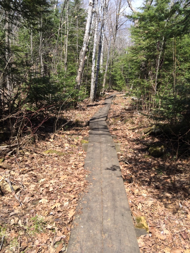
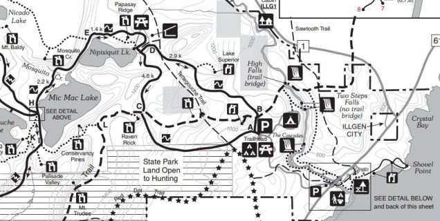
We wanted to hike for a good part of the day, so we chose to head out on the loop towards Nipisiquit and Mic Mac Lake. Since it was still spring time (early May) the trails were relatively muddy, the first incline coming out of the parking lot towards Lake Superior lookout was very muddy and wet. The trails were pretty big in most parts, like the below picture, so it made it easy enough to try and navigate around the boggy parts.

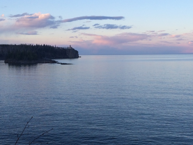
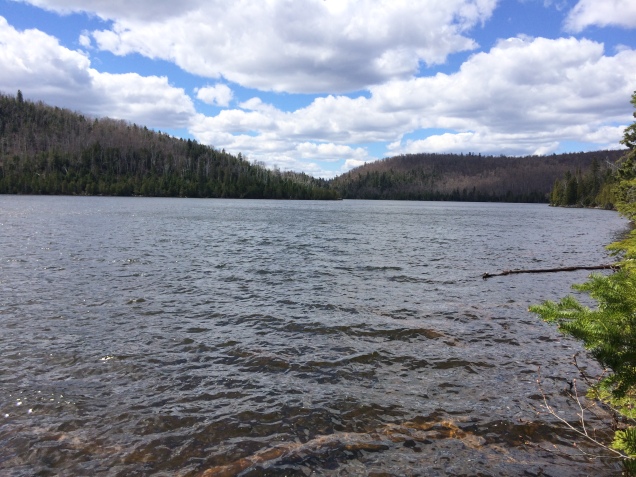
The Lake Superior lookout was somewhat steep to get up to, but it was beautiful and you could easily get a good panoramic view of the area. After getting back on the main trail it was pretty level for a good length and gave us time to recoup. We got to Nipisiquit Lake and the little picnic area after about an hour of hiking, we stopped and had a snack and enjoyed the view of the lake. The lake seemed to come out of no where and it was really peaceful, perfect place to take a break (i.e. there were NO people around).
Now here comes the part that kind of got us off track 😉 After our break, we were trying to decide what route to take towards Mic Mac Lake. On the map there was supposed to be a little trail along the lake that met up with the larger trail or the larger trail going up the ridge with an overlook that eventually came back to the lakes. Since we were enjoying the views of the lake, we opted for the trail along the lake. As we were leaving the picnic area, we seemed to pick up a solid trail and headed into the woods. It started to grow more and more faint, which sometimes happens with sparsely used trails. About halfway through the trail (past of the point of no return), the brush totally overtook the trail and there was really no indication of the trail. Thankfully, the trail was supposed to go along the lake shore until it met up with the other trail, so we just bumbled through the brush along the lake’s edge. I had never been so happy to meet up with a main trail before. Needless to say, we wasted a lot of time trying to make our way through that mess.
Back on the main trail we were welcomed with much better trails and here there were even boardwalks over some of the more soggy areas, which was much appreciated. The trail between Nipisiquit and Mic Mac Lakes was my favorite part of the loop we took, it was in the woods and had the classic northwoods smell and feel. The trail in this section was relatively level as well, making for a very relaxed section.
The trail passes through the Tettegouche Camp, which is a cluster of cabins on Mic Mac Lake that are available for rent. It if I was the cabin type of girl, I would consider renting one of these.. although they aren’t super secluded, they had good trail access and were relatively secluded from most of the park visitors. From the Camp we took the trail towards Palisade Valley Overlook. The trail looping back towards the parking lot was the same trail type as the sketchy / non-existent trail that we took earlier, so we were a little nervous to see the condition of this section.
Surprisingly, the trail was well defined the rest of the way back to the lot. Based on the topography on the trail map we had, we thought we would be skirting a lot of the big ridges. The good news for our exhausted legs, we got to go up ALL the ridges and at some points going up hills only to go down hill and then directly back up. I am normally not a whiner, but we were (I was) so tired at this point. We went up to Conservancy Pines overlook, but you couldn’t really see a lot from that viewpoint (not worth the steps at that energy level). The trail connects with the Superior Hiking Trail (SHT) for a short while and it was nice to be able to get a feel for the condition of the trail and signage before committing to a full hike on that trail.
After we got back on the regular trail and within two miles or so of the parking lot, the trail was relatively easy as we were going downhill. There were fewer muddy spots on this side of the trail than the way we came in, but it was still pretty boggy in spots. This side of the trail abuts park land that is open to hunting, which was enclosed by a fence. When we got back to the parking lot, I was very happy to be done with the hike even though it was very enjoyable. It was about a six hour hike with about 160 floors hiked according to my Fitbit and I was a tired lady afterwards.
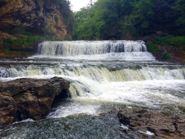
We’ll have to come back sometime, since we didn’t make it to Shovel Point, Palisade Head, or High Falls. Never enough time to see everything!
Until next time!