My family takes an annual trip to Northern Wisconsin in fall and Copper Falls is a place we visited last year while on one of our day trips. The funny thing is we actually went the year before (or should I say tried to go), but it was getting late by the time we got there. We ended up hiking half of the trail in the dark with no flashlights. One could say it might be a family trait to try and do more than there is actually time for while on vacation.
Copper Falls State Park
Located ~4o min from Park Falls, WI
Part of the Wisconsin State Parks system
On this trip to Copper Falls State Park, we arrived in the early afternoon to make sure we had plenty of time for hiking and exploring what we remembered as a great park. We decided to take the Doughboys’ Nature trail, which I imagine is the most popular trail in the park, because it goes along the Bad River and there are views of a number of falls and cascades. The trail is only 1.7 miles round trip, so we also walked up to the Observation Tower that is on the CCC 692 trail, which is along the Doughboys’ trail.
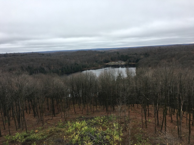
We decided to hike the trail counter clockwise and head up to the Observation Tower first while we still had energy. The hill and stairs that take you up to the tower could definitely deter some people, especially if they’ve hiked a number of other trails already in the park. I imagine the view from the tower is quite stunning when the trees are in peak fall colors. Usually by the time we take our trips most of the leaves are gone, but that’s fine with us because most of the people are also gone. The CCC trail continues on for another mile from the tower, eventually connecting back with the Doughboy trail, but we wanted to walk along the river, so we headed back the way we came.

The Doughboy trail is quite wide and there are many spots where you can get views of the river, but there is railing along the trail to deter people from going onto the ledges overlooking the river. Pretty quickly you can get a good view of Copper Falls, you can also get a view of on the other side of the river. The trail is often covered in pine needles and leaves, which was a little dangerous on the day we were there since it was a little rainy. In the section where there are stairs, near the river crossings, it’s advisable to use the handrails.

After the bridge by Devil’s Gate there is a trail that splits off for the North Country Trail and we (I) just had to hike for a little ways. As I become more experienced at backpacking I would like to section hike some of the long distance trails in the area (Superior Hiking Trail, North Country Trail, and Ice Age National Trail), but that is a topic for another time! The short walk we took on that trail seemed like the trail was well maintained, but obviously not nearly as wide the rest of the trails in park.

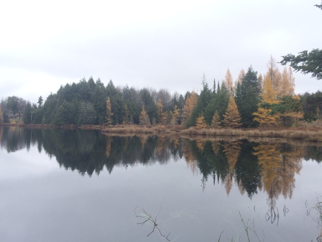
Getting back on the main trail there are some more stairs up a hill, but not too many, and then you’re rewarded with views of Brownstone Falls and then the Cascades shortly there after. I am forgetting now (see the problem with writing posts four months after the event?), but either Brownstone or the Cascades have a nice overlook that is worth going out to. Some really great pictures can be captured from these vantage points.

There’s another bridge and one final view of Copper Falls before arriving back at the parking lot. There are also some much needed outhouses along this section, I believe this is also were the handicap accessible section of the trail connects to the parking. If it was a nicer day we could have stopped in the pavilion near the parking lot and had our lunch. It’s also worth noting that there are signs along the trail that talk about the geology that formed this unique area, which was surprising to all of us.
Until next time!

More pictures of Copper Falls State Park:


Links and pictures to other places of interest in the area that we visited: