Fundy National Park

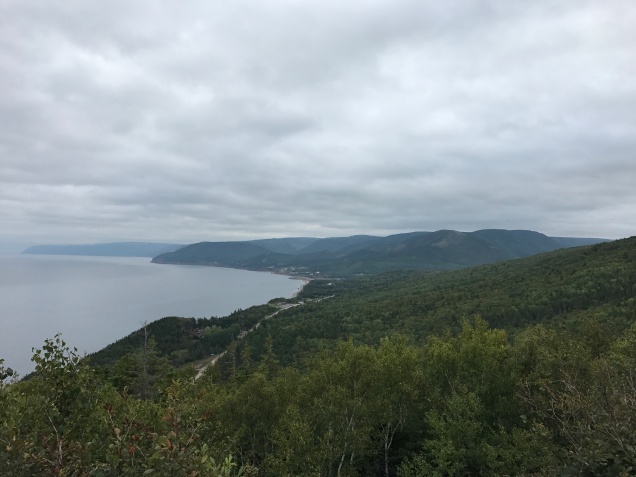
Park #3 of our Canada trip (and the last part that was actually in Canada)!

Fundy National Park

Part of the Canadian National Park System

~ 1 hour Southwest of Moncton, NB

After our hotel stay the night before, we got up, enjoyed our free breakfast, and were on our way to the next adventure – Fundy National Park! We would actually be leaving Nova Scotia and heading back to New Brunswick. As we crossed the border we had to get pictures of both province signs (for the BF), since we didn’t get an opportunity the first time since we came into Nova Scotia from a ferry.

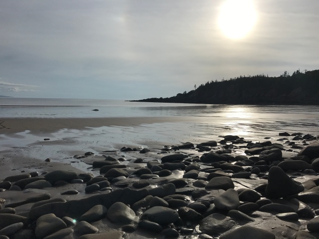
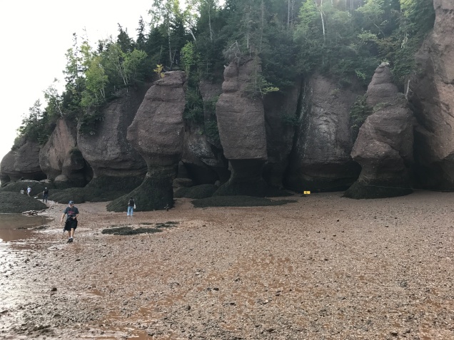
Our first stop before getting to Fundy was Hopewell Rocks, which is an attraction along the Bay of Fundy. The Bay of Fundy has an extreme tidal range, so depending on the time of day it looks like either you’re driving next to water or pits of dirt and mud. Hopewell Rocks is quite unusual that there are flowerpot shaped rocks along the coast that get exposed and covered with water twice a day. The tidal change is so large, that you can actually walk on the floor of the bay. It was interesting to experience and the rocks themselves were pretty cool. The admission fee was ~$10 CAD and felt reasonable for the small hike, break from driving, and cool experience we got.

IMG_5206
Some people for the perspective on the size @ Hopewell Rocks

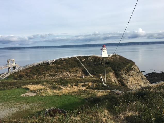
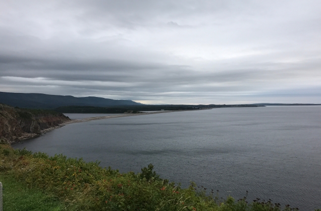
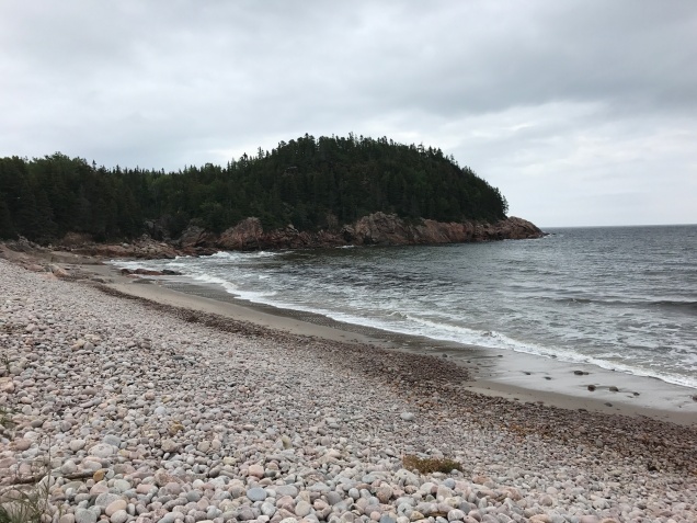
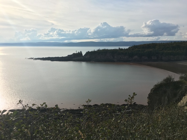
The last stop before the park was Cape Enrage, about 20 minutes from Fundy. There were two things that drew us to Cape Enrage – a lighthouse and the views of cliffs. Although, if the visit wasn’t free we likely would not have made the stop. We only stopped for a brief bit at the lighthouse, since it was close,d but spent more time wandering on the beach that had views of the lighthouse and surrounding cliffs. Eager to get to the park and settled for the day, we quickly headed onto the park.

IMG_3294
View of Cape Enrage from the lighthouse

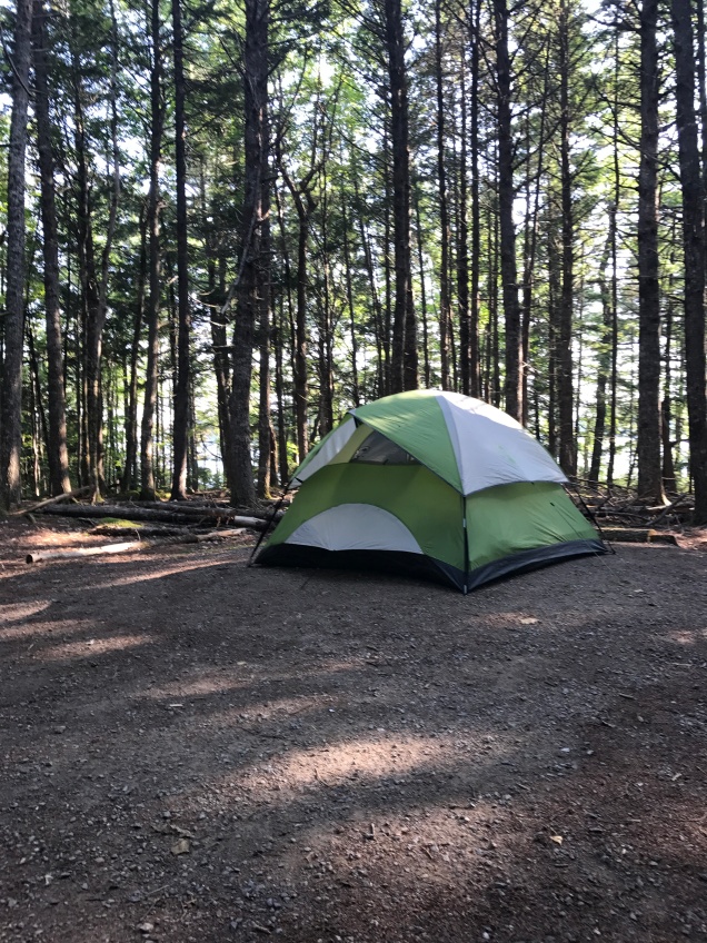
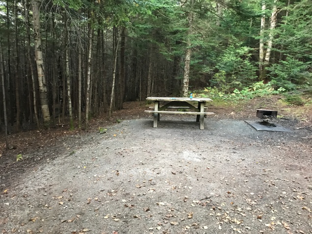
We were staying in Chignecto Northcampground and this was one of the best campsites of the trip, tied with our site at Acadia National Park. The campground provides you with recycling and trash bags to encourage everyone to put their trash in the right spot, something I really liked. Our site was in the middle of the woods and it had good separation from the sites around it. The campground also had a washing station. I wish I could just permanently camp with the amenities provided in Canadian campgrounds. It started getting dark soon after we got there, so we quickly got our fire going and dinner made.

IMG_5234
Campsite with cute cooking grate

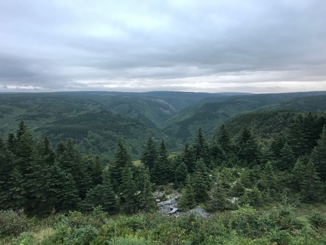
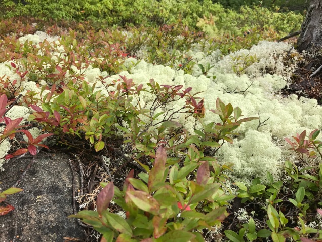
We got up early the next morning, we only had one day in the park, but didn’t have to be to our next destination until late in the day. There were a few hikes on the agenda for that day, specifically Dickson Falls trail and Caribou Plain trail. Both hikes were pretty short, only a couple miles each, but they give a different taste of what the park has to offer – waterfalls, woods, and bogs. We didn’t get a chance to drive down the coast to experience those views in the park, but that means we’ll just have to be back another time.

IMG_5241
One of the many falls along Dickson Falls trail

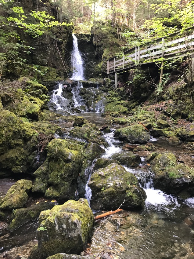
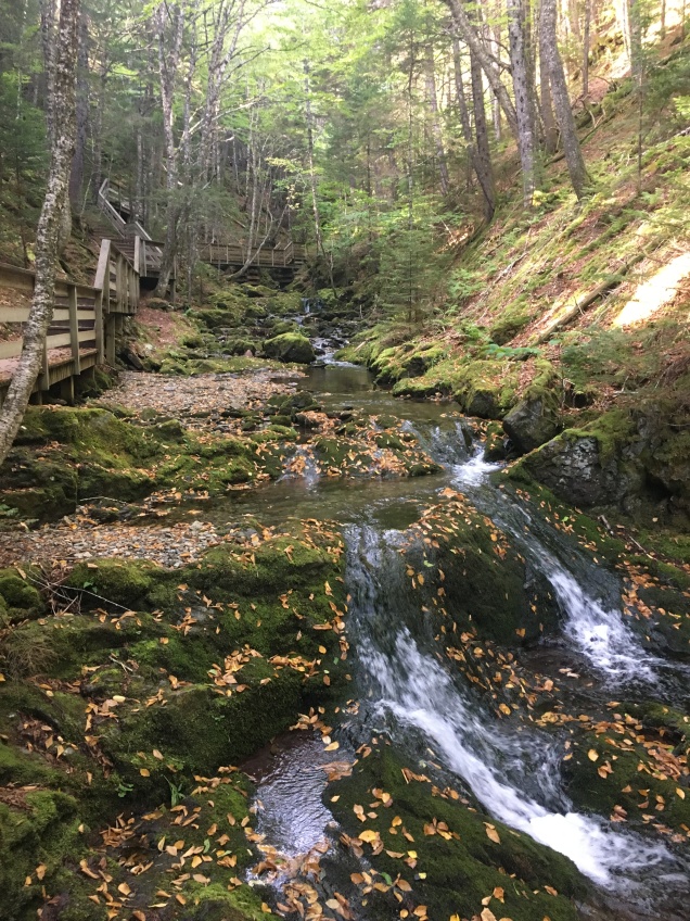
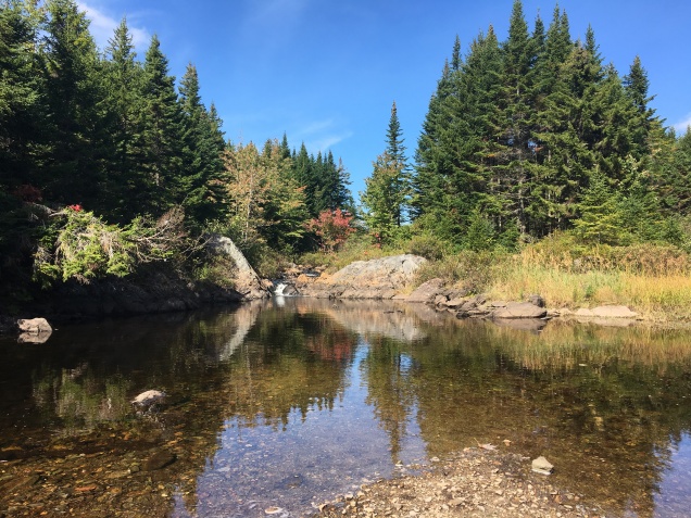
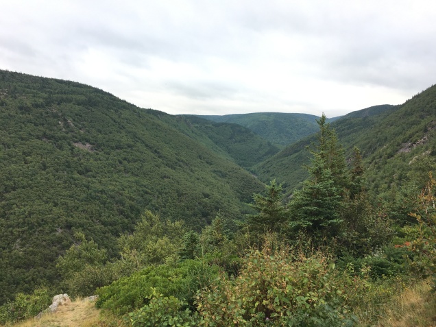
We went to Dickson Falls first because it was closest to our campground. It was good that we did this trail right away in the morning because it is one of the more popular trails in the park because of the shorter length with multiple cascades along the trail. The trail is a loop, so you can go either direction, we went clockwise. The trail leads you down a hill to get to the cascades and then you walk along them until you start ascending the hill again on the other side. None of the waterfalls are particularly large, but beautiful in a meandering way.

IMG_3308
All along the creek there was so much moss

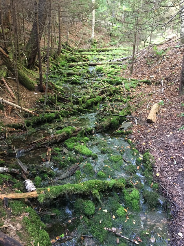
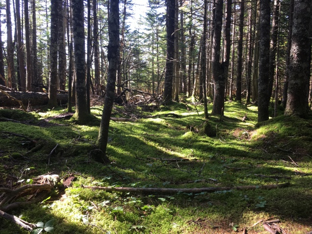
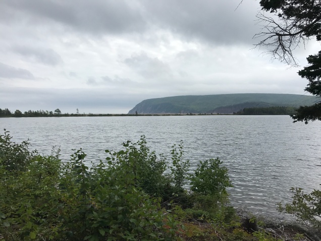
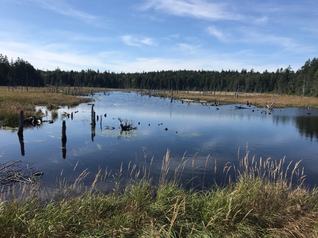
On our way out of the park and back towards Maine, we stopped at Caribou Plain trail to hike and eat lunch in the picnic area by the trailhead. Like I mentioned earlier, this trail was very different than Dickson Falls trail. There were bogs, which reminded me of Minnesota, and plenty of pine trees and moss. The trail is a relatively flat loop and there are patches of boardwalk to get you over marshy areas. The pinnacle of the hike is the platform next to Caribou Lake, it overlooks the lake and you can imagine caribou, or nowadays moose, watering here.

IMG_5249
Caribou Lake along Caribou Plain trail

We looped back towards the car, going over a few slight inclines, enjoying our last moments in the park. We decided to eat lunch at the trailhead before continuing on with our drive. The picnic area is nothing special, but it was in the shade and there weren’t any bugs, so that was a winner for me.

We left Fundy National Park, much in the same way we did Cape Breton National Park, already talking about what we would do when we come back next time. There was so much left unseen and hiked because of our short time in the park.

Until next time!

Signature

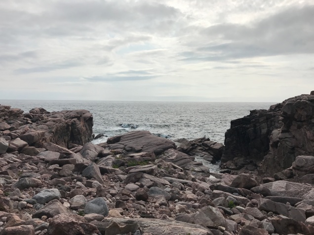
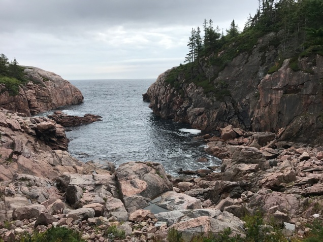
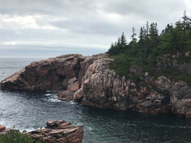
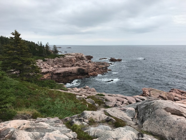
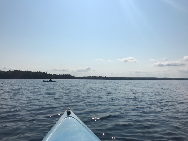
Just a few more pictures I have to include 🙂

IMG_3292
View of the lighthouse @ Cape Enrage
IMG_5233
Another view looking out onto Cape Enrage – @ high tide the water is over these rocks
IMG_3303
There were cairns all over the beach @ Cape Enrage
IMG_3311
Another view along the Dickson Falls trail
IMG_3324
Along Caribou Plain trail
IMG_3329
View of the beaver dam along Caribou Plain trail

Cape Breton Highlands National Park

Park #2 of the Canada trip! Cape Breton Highlands couldn’t be more different than Kejimkujik, which was lakes, lush forests, and land locked. Cape Breton, from what I had read online, would be expansive vistas, steep hiking, and lots and lots of ocean views. Boy, did it not disappoint!

Cape Breton Highlands National Park

Part of the Canadian National Park System

~3 hours East of New Glasgow, NS

Cape Breton Highlands National Park is located on the opposite end of Nova Scotia from Kejimkujik NP, so we had roughly 6 hours of driving to get there. Cape Breton Island is not connected to Nova Scotia by land, but only by a driving causeway and the island has a different feel than the rest of Nova Scotia. I included a link because the history of the island is actually quite interesting, but I won’t wax on about that here. The Cabot Trail runs through the park and is an attraction in of itself as one of the most scenic drives in the world. As we neared the park on the northern side, we passed through the town of Cheticamp, which is a predominantly French town with French flags hanging outside many of the houses.

Screen Shot 2018-05-12 at 3.49.38 PM

We were camping at Cheticamp campground, which is just inside the park near the town that the campground is named after. We were happy to be at our destination and having arrived before the kiosks were shut down for the night, so we could get some firewood and ice. The campground is very open, there is no brush between sites and the sites are rather close to each other. Thankfully we were arriving on a Monday, so the campground wasn’t full and we were able to feel that we had some privacy.

img_5130.jpg
One of the first overlooks, gloomy skies

It was quite windy and wet, so we quickly got the tent set up and decided to go explore a little before nightfall came. We drove along the northern shore of the island and stopped at the many lookouts, going as far as Wreck Cove before it started to get too dusky that we decided to head back to camp. We spent the rest of the night relaxing at camp with our fire.

IMG_5134
An inland view of the highlands, so beautiful!

The next morning we quickly packed up as we had a full day of sightseeing planned. We were only staying at the park one night, but were staying in a hotel that coming night so we had much of the day to spend exploring the park. We continued our drive around the island on Cabot Trail.

IMG_5147
First views of Neils Harbor, it’s still cloudy

Our first stop, besides a refueling stop, was at Neils Harbor a small town on the boarder of the park. There is a lighthouse that overlooks the harbor, you can’t go in it, but who can turn down looking at a lighthouse?

IMG_5152
The cute lighthouse in Neils Harbor

Second, we stopped for our hike of the day – the Jack Pine loop! We had a hard time deciding what trail to hike, since many are either very long or barely a half mile. The Jack Pine loop at ~ 1.5 miles did not disappoint, the trail was relatively easy, but offered views of the ocean and Jack Pine forests. It was still relatively early in the morning, so we were the only ones on the trail for most of the hike. After the hike we checked out Black Brook Beach, which is right next to the trail head.

IMG_5159
Along Jack Pine trail

We continued on our drive, stopping at Green Cove, Broad Cove, and Ingonish Beach. All of these either had short hikes to overlooks or were ocean views. At Ingonish Beach, we hiked Freshwater Lake trail, which was another short mile hike, before eating our late lunch in the picnic area. The lake is pretty interesting in that is separated from the ocean by only a small strip of land.

IMG_5184
Freshwater Lake with the Atlantic Ocean on the other side

After our lunch, we were on our way to our hotel in New Glasgow. We were both sad to leave this park and we’ll have to come back at some point because we didn’t scratch the surface of all the things there are to do in this park. If you spent a week here, you could really sample all the park has to offer.

Until next time!

Signature

More pictures I just had to include because I could not stop taking pictures here!

IMG_5154
Another view of Jack Pine trail
IMG_5153
Slug bug on a mushroom

IMG_5157

IMG_5160

IMG_5161
The lichen here is so fluffy looking

IMG_3222

IMG_5167
Coastal views along the Atlantic

IMG_5172

IMG_5175

IMG_5176

IMG_5179

IMG_3239

IMG_5181

Kejimkujik National Park

It seems that every year we’ve been doing a lot of smaller trips and then one big trip. Well this is it folks, this is the big trip of 2017. We flew into Portland, ME, rented a car, and drove directly to St John, New Brunswick (Canada, people!!). The following day we took a ferry to the island province of Nova Scotia, we were enjoying the Maritimes for all they’re worth, and thus begins our trip of four national parks in a week! The first of which is Kejimkujik National Park.

Kejimkujik National Park

Part of the Canadian National Park System

~ 2 hours east of Dartmouth, NS

After our day or so traveling to arrive at the official start of our trip at Kejimkujik NP or the “Keji” as the locals call it, we were so excited to be here. We arrived around noon ish and were spending one night here before heading on towards Cape Breton Highlands National Park. In total we had a day to spend here, but planned to make the most of our time.

Screen Shot 2018-04-11 at 8.55.37 PM
Map of the area we explored, courtesy of Parks Canada

We were staying at the Jeremy’s Bay Campground in the Jim Charles loop. The first thing I really noticed when doing research and planning this trip was how large some of these campgrounds can be at Canadian National Parks, this campground had 360 campsites. We didn’t really experience this when we were in Alaska because everything is a little more remote and gets fewer visitors, so this was a bit of shock and something that made me apprehensive that we would all be camping right on top of each other. In reality, despite the number of sites within the campground, there was ample space between the sites. Although there wasn’t a ton of brush or small trees creating privacy, the sites were at least far enough away from each other that you didn’t hear everything that your neighbors were doing. Given the size of the campgrounds, they certainly had plenty of amenities, which were nice, like plenty of firewood stations, ice, and free trash / recycling bags. They even had washing stations for your dishes to discourage you from creating a mess at your site.

IMG_5129
The campsite & ever faithful Coleman tent

When we first arrived, the people who were the previous occupants of our site were still packing up, so we drove over to Meadow Beach that’s in Jeremy’s Bay and hung out and relaxed for a little while before heading back over to our site. Once there we quickly set up and made our lunch while debating what we wanted to do with the rest of our afternoon. The BF was strongly suggesting the idea of kayaking or canoeing on the park’s namesake lake, while I was leaning towards exploring the hiking trails in the park. It was a beautiful day, nice and sunny but not too warm, so we decided to check out the lake situation. After talking with the woman at the kiosk at Jake’s Landing (the main launch point for anything lake related), we were convinced to go kayaking. The lake was apparently abnormally calm that day and the temperature was just right.

IMG_5120
The lake and calm waters

The lake is large and there are a number of islands in the middle that you can camp on. If we lived closer, this would certainly be something we would want to come back and do sometime. There were others on the lake, but with the size of the lake and the number of things to see we never ran into anyone or felt crowded out. We rowed around the lake for a few hours until our shoulders were sufficiently sore, enjoying the sunshine and light breeze on the lake.

IMG_5122
Another shot of the lake & all the islands!

We headed back to our campsite and then hiked around on some of the trails that were close to our site for a while before coming back and making dinner. We had a fire that evening and relaxed with some wine and beer by the fire, savoring the first night out in the woods on our vacation.

The next morning, we ate breakfast, lingered around, and then packed up and left. As we were headed all the way to the eastern end of the island to Cape Breton, we wanted to get a move on so we wouldn’t get there super late at night.

Until next time for the rest of this story!

Signature