The last leg in the Canadian trip – Acadia National Park! We headed to Acadia directly from Fundy National Park, so we had to deal with crossing the border and a long drive. But we would be staying in Acadia for two days before heading to Portland, ME to fly back to our real lives.
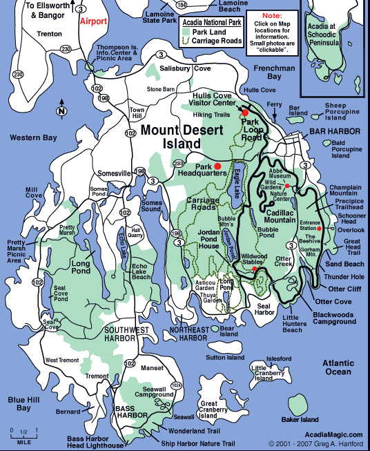
Acadia National Park
Part of the National Park System
~ 3 hours Northeast of Portland, ME
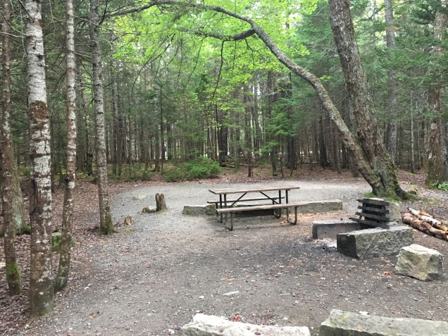
We made pretty good time considering all the hiking we did in the morning before heading to Acadia and arrived around dusk. Thankfully this gave us enough time to get checked in, find our campsite, and get set up before dark. We were staying at the Seawall campground, which is on the less popular side of the park called Southwest Harbor. As the name hints at, the campground is just across the road from the ocean and you could hear the ocean from the campground. The park ranger also told us, as we were checking in, that we had one of the best campsites in the park. Such a cool way to end the trip. 🙂
We relaxed at camp for a while and ate dinner, enjoying our large and very private campsite. As night fell we decided to head over to the beach as the park was having a star gazing party that night. There were plenty of people at the beach and the park had some glow sticks for people that didn’t have flash lights. Unfortunately, the stars didn’t want to show themselves that night and just hid behind the clouds. It was our first time trying out one of the ranger programs at a park, and although the skies didn’t cooperate, it was a great experience and is something we’ll continue to do in the future.
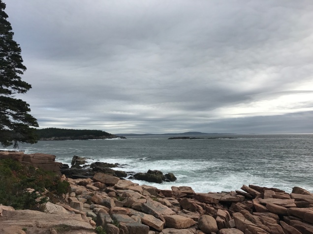
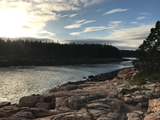
The next morning, we got up early and wanted to do the park drive loop before it got too busy. Acadia is a little different than most parks that there is private land / towns interspersed with all of the park land, so the park road has some town traffic and tourists. We drove over to the Hulls Cove Visitor Center, which is on the opposite side of the island from our campground, but is the official start of the park loop road. We went clockwise around the park road loop, hitting sites like Thunder Hole and Otter Point and stopping at the many pulls offs along the way.
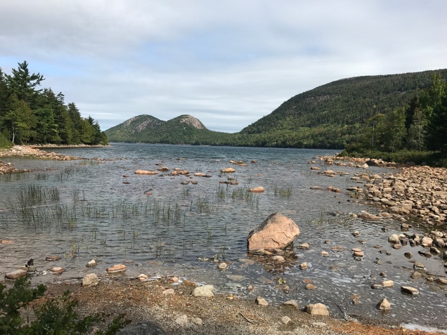
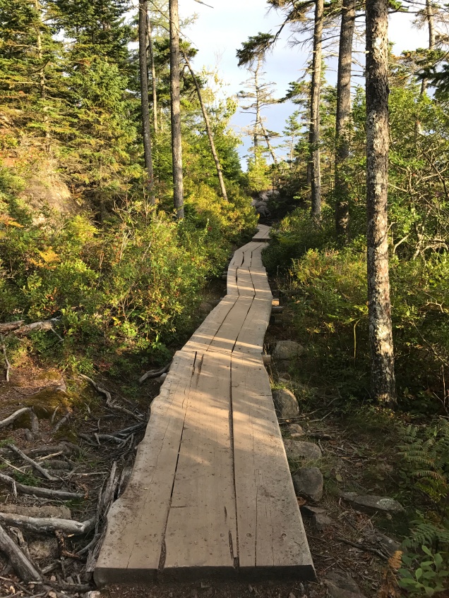
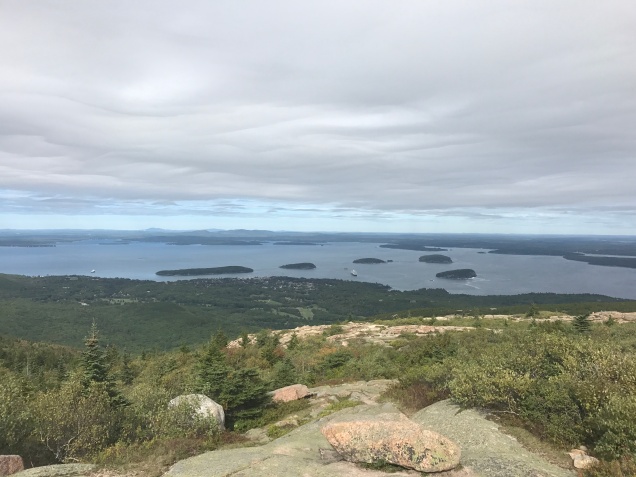
After completing the park loop, we decided to hike the Jordan Pond loop and walk around Cadillac Mountain before locating lunch. Jordan Pond loop is a 3.3 mile hike that is pretty easy stroll with the exception of some boulder scrabbles on the western side of the loop. There were a lot of people out at this point, but the trail still wasn’t overly crowded. There are some great views of the surrounding peaks from the trail, not to mention the clear pond water. After completing the loop we drove up to Cadillac Mountain and did the loop around the peak. We found where all the other tourists were, but rightly so, the views from Cadillac Mountain were spectacular. We hung out up there for a while, enjoying all the views despite the wind that never seemed to stop.
It was lunch time and what better thing to eat in Maine than lobster, so we were on the hunt! We ended up eating at C-Ray Lobster and we were not disappointed, we got the Lobster Dinner for Two, which came with lobster and mussels. All of the seating is outside picnic tables and the day was beautiful, so we relaxed for a while after finishing our meal. On our way out we decided to get a lobster roll and clam chowder for later because the food was so good.
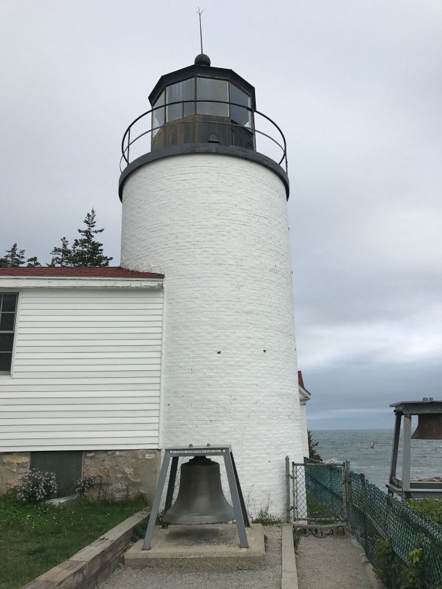
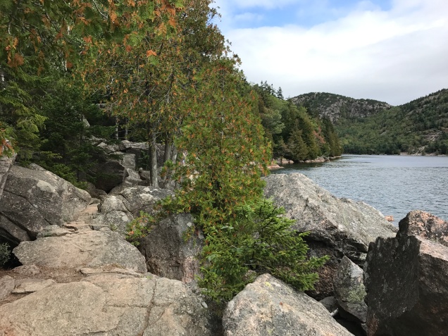
Before heading back to camp for the night, we went on one last hike on the Southwest side of the harbor. First we went to Bass Harbor Head Lighthouse, which is just a park and look attraction. It is still a functioning lighthouse, there is actually a couple living there, so they limit how much you can view for their privacy. We then went on to hike Ship Harbor trail, which is a 1.3 mile loop that goes along the opposite side of Ship Harbor from the lighthouse. The extreme tidal range also effects this area, as we were hiking the mudflats of the harbor were disappearing as the ocean was coming back in. This trail was very quiet, I think we only saw two other groups and it was nice to be able to sit on the rocks at the coastal end of the trail and just stare out at the ocean. The Atlantic Ocean is darker and moodier than the Pacific, there’s something about it that just draws you in.
Back at the campsite, we enjoyed our last night camping of the trip. We had another day before flying back, but would be heading over to Portland because we had an early morning flight. We enjoyed the beautiful night and reflected on what a great trip we’d had and all the things we wanted to come back to explore more. Similar to our Alaskan trip, we had found some areas that really spoke to us and we’ll definitely be back!
Until next time!